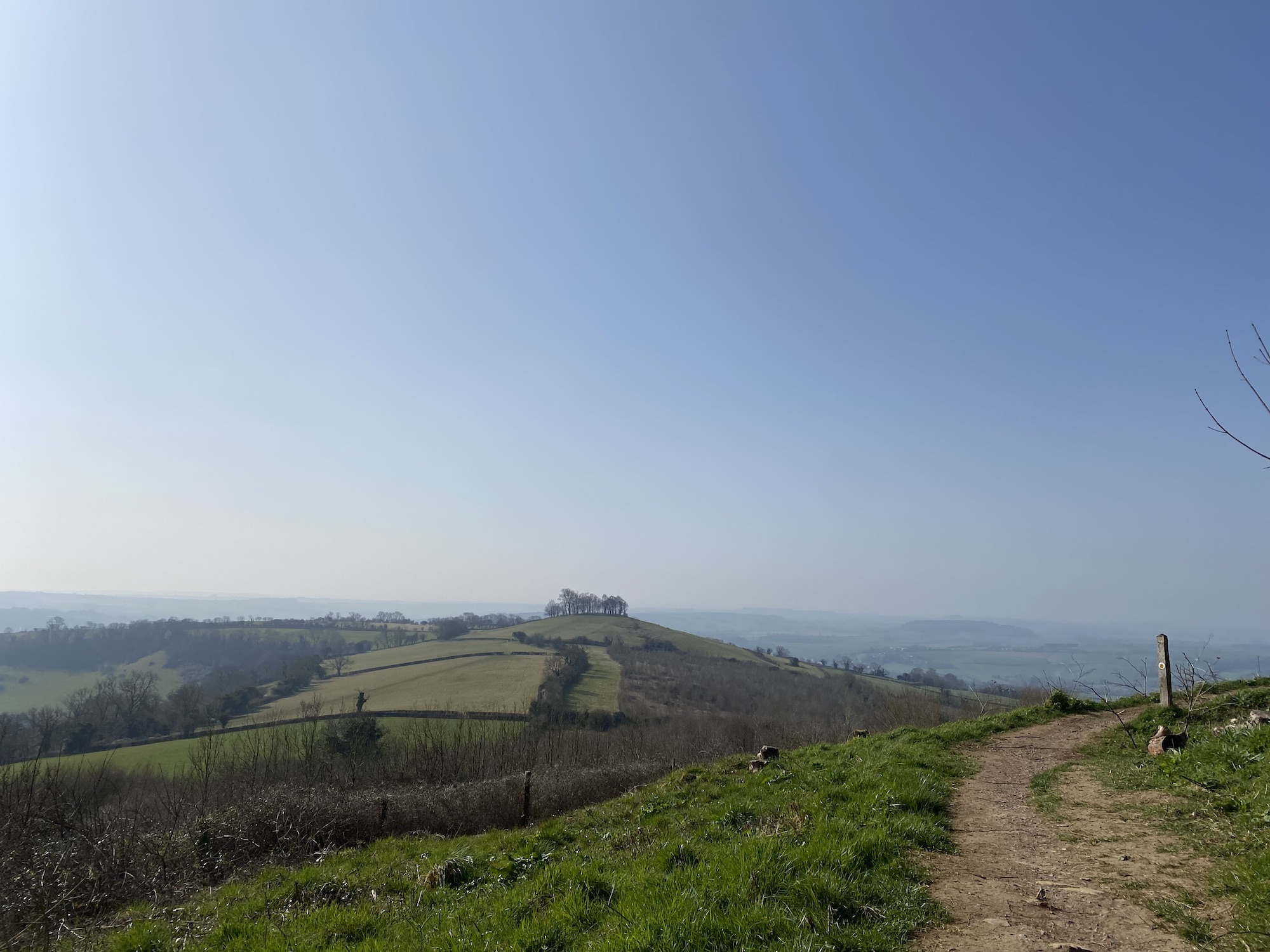
This Kelston Round Hill circular is a classic Bath walk with incredible views and a great cafe or pub pit stop. The conical hill with a clump of trees is instantly recognisable from all over Bath and it’s on the Cotswold Way linking to plenty of trails depending on how long you’ve got.
I’ve done a few routes but this is my favourite. I start at Bath Soft Cheese where there’s plenty of free parking, pick up a coffee then a short path links to the footpath. At the top the path loops round towards Lansdown before turning towards North Stoke making it a 7km loop taking me about 2 hours. Make sure you find the return path through the field, walking along the road is pretty hairy! For a slightly longer walk head down to the river then back up to the cafe.


MAP & DIRECTIONS
Walking Map & Directions – below is a fully interactive map with directions, elevation & distances. Download the plotaroute app to follow the route on your phone with a few simple steps.


THE WALK HIGHLIGHTS
Easy to follow footpath to the summit
In summer the hill is covered in wildflowers.
Perch on the bench at the summit with the perfectly worn groove to take in the views.
Follow the Cotswold Way up to Prospect Style with great views back to the round hill and beyond.
Look out for hot air balloons often drifting this way.
Factor in Bath Soft Cheese Cafe which makes a perfect lunch spot, book in advance if you want a table or hut as it’s very popular but you can usually find a seat by the play area.
There’s also a super pub The Old Crown Inn in with a beautiful garden out the back.
Kelston Round Hill is an ancient burrow, a burial ground. The distinctive “clump” of trees is visible from all around Bath and were apparently planted at the end of the 18th century. The famous Kelston Round Hill clump is an important local landmark and is currently undergoing a programme of replanting and tree care to encourage natural diversity and ensure its future. To protect the new trees from deer predation, a fence has been erected. It goes around the perimeter, connecting the 3 permissive walking paths.
OTHER WALKING OPTIONS
Short 3km 1hr circular walk down to the river from the cafe
Bath Soft Cheese site links to a longer circular walk


PRACTICAL INFORMATION
- TERRAIN: Partly paved road and marked footpaths which can be rocky and muddy. Fairly steep ascent to the top.
- PARKING: Map. Free parking at the cafe
- LENGTH: 7km / 4.4 miles – plenty of options to shorten or lengthen
- DURATION: 2hrs
- ELEVATION: 248m total ascent to the trig point
- DOG FRIENDLY: Yes, livestock grazing in some fields
- PUB & CAFE OPTIONS:
