Distance 5km to 11km, circular walk, with great views and pub
This is an easy to follow route with the most spectacular views. Do a quick loop round the top or extend all the way round. The walk starts with a short but steep climb to the highest point in the Mendip Hills at 325m. Choose a clear day and you’ll get an incredible 360 degree views across to the Bristol channel, Chew Valley lake, Quantock Hills and planes landing at Bristol Airport. The top’s covered a patchwork of grassy heathland and dense bracken and gently slopes down to Rowberrow Warren Woods. There’s plenty to see with bunkers, caves, grazing poines and cattle. And make sure you stop off at The Swan for some delicious grub or a refreshing pint.
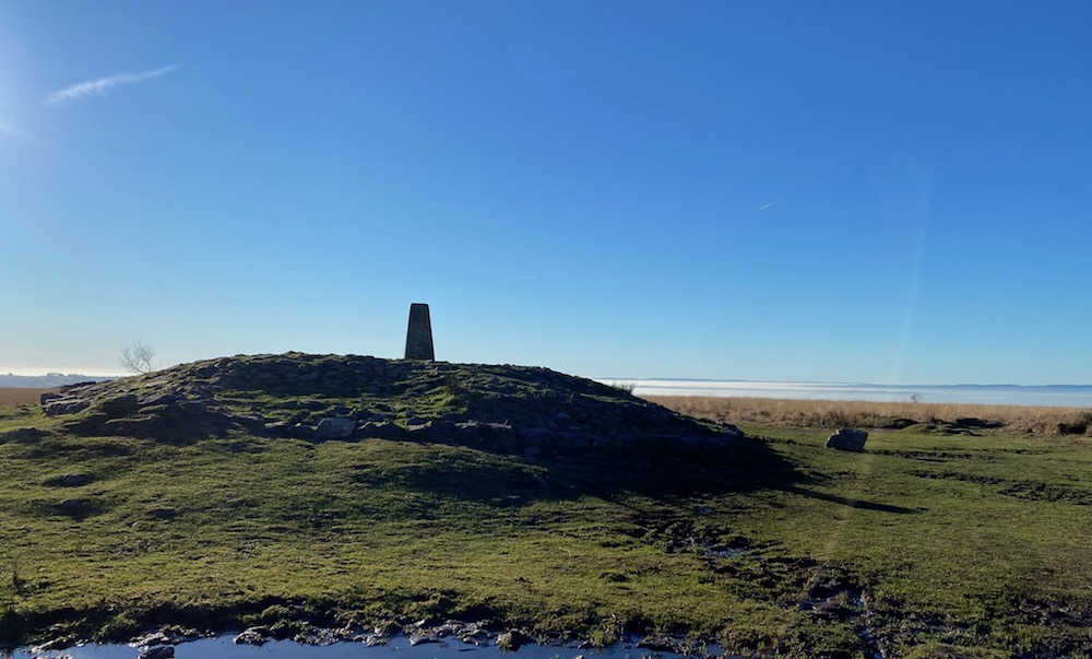
I chose a pretty spectacular day for this walk. The clouds hadn’t yet lifted so once I reached the trig point at the top they created the most incredible sight. It was early January and after plenty of rain so it proved pretty boggy and despite wearing walking boots I found it hard to get around some spots. This walk is definitely one to add to your list!


MAP & DIRECTIONS
Walking Map & Directions – below is a fully interactive map with directions, elevation & distances. Download the plotaroute app to follow the route on your phone with a few simple steps.


THE WALK HIGHLIGHTS
(For step by step instructions click into the plotaroute map above.)
- It’s a fairly steep but short walk from the car park to the trig point at the top, the highest in the Mendips at 325m.
- The summit area of Black Down is known as Beacon Batch. It is the site of Bronze Age round barrows, a mound of earth raised over a burial placed, one of which also anchors the concrete trig point. All of the barrows show signs of being opened in the past.
- Across the top there’s also rows of tumps, small mounds, created in World War II to prevent enemy aircraft from landing.
- I passed a couple of herds Devon ruby red cattle which were quite intimidating.
- There’s also Exmoor ponies but I didn’t seen any.
- Check out the bunkers. During the Second World War Black Down was used as a bombing decoy site, part of a national programme to decoy German bombers away from towns and cities. Bomb-proof bunkers housed generators and control switches that enabled the RAF crew who staffed the site, to simulate an inadequately blacked-out city.
- The combe contains several caves, most accessible being Aveline’s Hole right beside of the road, and another two in a thickly wooded side valley; Goatchurch Cavern and Sidcot Swallet.
- The Swan Inn makes a great half way lunch spot or you could start your walk here and enjoy a pint at the end.


PRACTICAL INFORMATION
- TERRAIN: Clear footpaths which can be rocky and muddy. Some parts are almost impassable during wet weather with deep puddles.
- PARKING: Map. Free Burrington Ham Car Park a short walk from the entrance to the walk.
- LENGTH: 11km / 7 miles – easily shortened
- DURATION: 2.5 – 3hrs
- ELEVATION: 248m total ascent to the trig point
- DOG FRIENDLY: Yes but beware there are huge bulls grazing on the top and ponies
- PUB:


