Distance 11km, 7mile hilly, circular walk, views & cafe
This walk has incredible valley views, which of course means hills. The first climb takes you to the top of Little Solsbury Hill, dip down around the back into Batheaston then a second ascent to the top of St. Catherine’s Valley. The route down is through beautiful, windy teletubby land meandering back into Batheaston where the lovely Gather Cafe awaits with mouth watering lunches and refreshments. Then take an easy, flat wander back along the river.
My husband recommended this route and I should know by now, as a mountain biker, this means hills!. I’m quite partial to a hilly walk especially when the hills are done in the first half, although I did find the second hill long and tough. All quickly forgotten when the remainder of the walk is long, meandering downhill with babbling brooks and alongside a river.


MAP & DIRECTIONS
Walking Map & Directions – below is a fully interactive map with directions, elevation & distances. Download the plotaroute app to follow the route on your phone with a few simple steps.


THE WALK
(For step by step instructions click into the plotaroute map above.)
- I’ve started the walk at Alice Park as there’s free parking in the car park or on road, a cafe and toilets (20p).
- After a short section of road, start your ascent towards Little Solsbury Hill, past some houses then onto a narrow path in woodland. It can be tricky to find the turnings, so check the map.
- At the end of the woodland path you’ll turn right onto the road for only a few steps then left into a field. Look out for some rather large llamas who are often in the field.


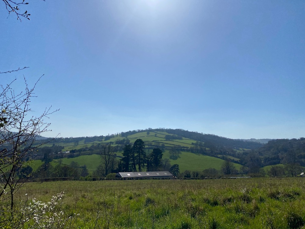
- Admire the views atop Little Solsbury Hill and make sure to spy ‘The Caterpillar‘, a neat row of about 50 beech trees on Freezing Hill in the distance.
- The path takes you down the back of Solsbury Hill and descends down towards Batheaston. The path will take you past Chris Rich’s Farm Shop, a family run business growing and selling fruit and vegetables in their market garden. There’s an honesty box for all payment.
- Check out Eagle House in Northend, its summerhouse was used, from 1909 to 1912, as a refuge for suffragettes who had been released from prison after hunger strikes.


- When you arrive in Batheaston there’s a few options that make a good pit stop. Choose from Gather Cafe, Robbie’s Plaice and The George & Dragon, all highly rated for their food and atmosphere.
- Take in the views and tranquility at The Riverside and Secret Garden beside the car park at Batheaston. Originally laid out as a formal walled garden to Batheaston House it’s now open to the public and is a real gem.


- Head down to the river path, past The Bathampton Weir which takes you back to Alice Park.


PRACTICAL INFORMATION
- TERRAIN: mixture of country footpaths, mud and grass, paved road and some very quiet road sections
- PARKING: Map. You can park for free at the Alice Park which has a small car park or there’s plenty of free parking on the road
- LENGTH: 11km / 7 miles
- DURATION: 2.5 – 3hrs
- ELEVATION: 338m total ascent, the second peak is half way
- DOG FRIENDLY: Yes
- CAFE:
- Gather Cafe currently only open during the week, worth checking.
- Robbie’s Plaice Fish & Chip Shop
- The George & Dragon
- Alice Park Cafe


