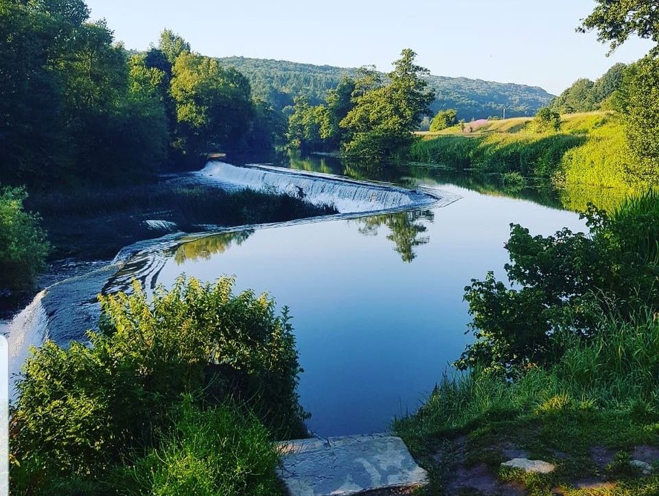
Warleigh Weir is one of the most popular swimming spot on the river Avon, about 4 miles from Bath. Even on a rainy winters day you can see why, it is stunning! We stopped to have our picnic here. The access point is a large flat grassy island, surrounded by lush countryside. There’s steps into shallow paddling spots and deeper parts across the river.
The weir was originally built to supply a head of water to a grist mill in Claverton. It was subsequently raised by 12 inches to supply water for the Claverton Pumping Station which pumps water up to the Kennet & Avon canal using power from the river flow diverted by the weir.

Claverton Pumping Station 
The Weir on Sunday 
and Tuesday, 2 days later!
- Warleigh Weir location
- Warleigh Weir Project. Access to the weir is via private land, owned by the Warleigh Weir Project. The project, led by Johnny Palmer has very strong values, to promote the sustainable use of the countryside to engage people with nature. The project is also, importantly, attempting to make the river Avon Designated Bathing Water which would mean cleaner waterways, healthier environment and greater biodiversity for everyone using the river. Go to their site to support the initiative.
- @Bathopenwaterbeauts are passionate open water swimmers and have an active Facebook group with helpful tips on wild swimming, cold water swimming and is a lovely forum to meet other swimmers. They also have great images of the weir throughout the year and kindly allowed me to use their image for this article.
- Cafe. There’s no facilities on site but for summer 2021 Chaiwalla will be taking up a casual spot selling Indian inspired street food. On offer will be zero-packaging, vegan, super-healthy and tasty wraps. A percentage of the takings go towards the Warleigh Weir Project which pays for tree planting, site improvements and other maintenance. Check their account for when they’re onsite.
- Parking. There isn’t any parking by the weir and it’s strongly recommended that you come by bike or walk. I’ve shown a few options we found on the google map below.
- We parked in Claverton, on the road beside St Mary’s Church and cut through the path, across the main road and down the hill to the weir.
- There’s a small lay by on the A46 main road
- There are a few spots on Ferry Lane but even on a quiet winters day there weren’t any available.
- You could also park at the Brassknocker Basin car park, by Dundas Aqueduct, which is metered and walk about 1.5 miles.
- Toilets. There are no toilets on site.


THE WALK
We really enjoyed this walk even though it was fairly simple and short, 3.7km (2.3m). We had the two children with us on foot.
- After the church there’s a narrow path on the right that takes you down to the main road.
- Turn right and walk along the path, crossing when you see Ferry Lane opposite.
- The weir is at the bottom of the lane just after the level crossing.
- We had a walk around the weir and then walked along the canal and returned back to Claverton heading up over a stile and across a field.
- Claverton is a really pretty village and we enjoyed a look around the churchyard where Ralph Allen is buried in a mausoleum.
Terrain: mixed terrain including off road for our route below.
Buggy: Yes. If you want to take a buggy just return via Ferry Road and avoid the field and stile route we took. It was a bit muddy and bumpy on the island but doable with a buggy.